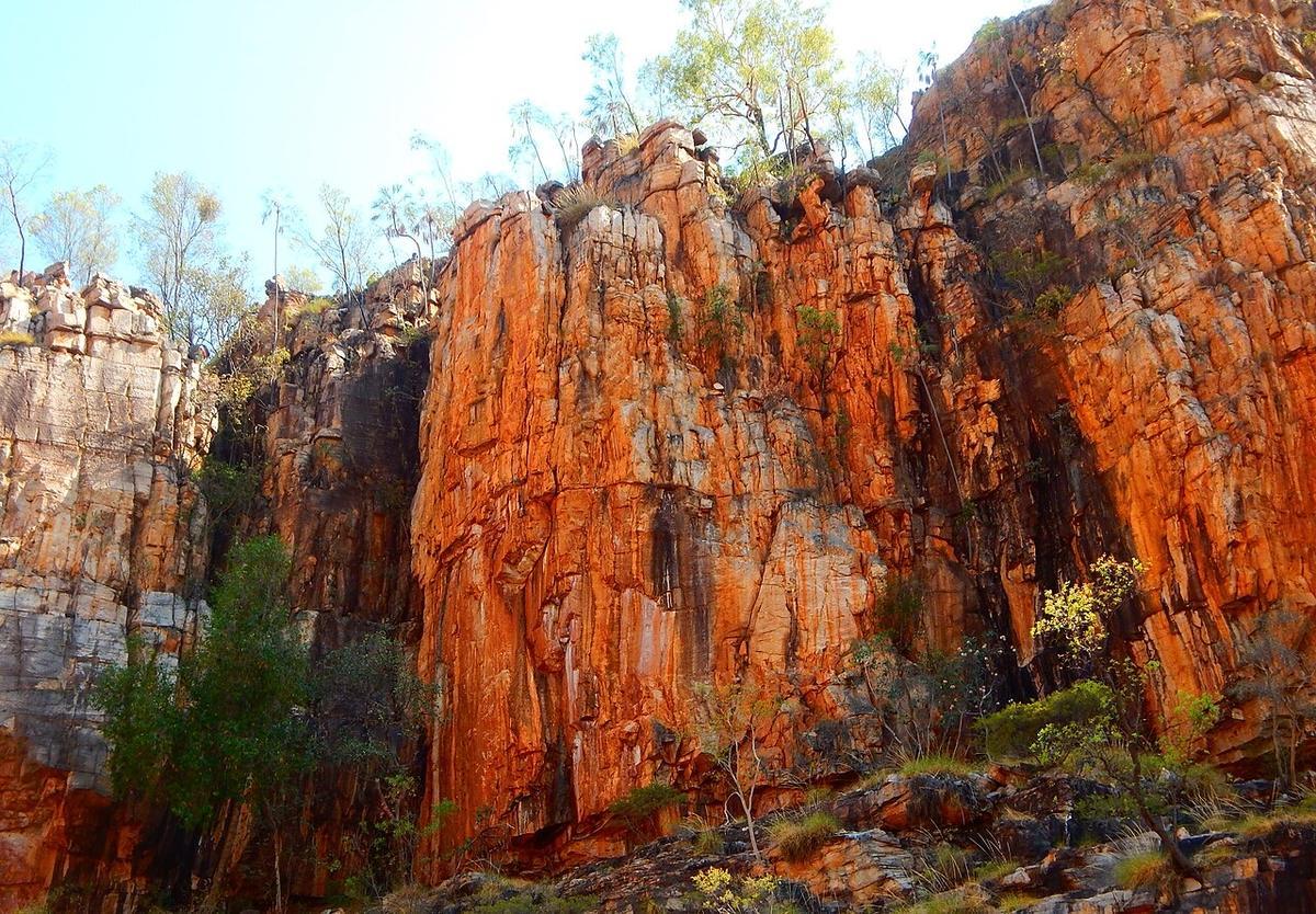
Nitmiluk National Park sits a short drive from Katherine in the Northern Territory, on the traditional country of the Jawoyn people. The Katherine River runs through it, and over millions of years that river has cut a series of sandstone gorges with walls rising sharply from the water. In the dry season, when the gorges are open, the water between those walls is slow and flat. The colour shifts from pale green in direct sun to deep shadow at the base of the cliffs. It is a significant and closely managed place. Paddling it takes preparation, respect for the rules, and an honest reading of the season.
The season is everything
The wet season closes the gorge to paddling and swimming, and it closes it for clear reasons. Flows rise, conditions in the gorge turn dangerous, and saltwater crocodiles move upstream from the lower reaches. The park runs crocodile management and surveys before it reopens water activities each dry season, and that process decides when and where paddling is permitted.
Do not plan a paddling trip to Nitmiluk without checking Parks NT and the park operators for current status. The reopening date varies. The areas open to swimming and paddling can change. This is not a formality. The closure exists because people have died in these waters, and the risks behind those closures do not vanish once the gorge reopens. Follow every current instruction from the park.
The dry season runs roughly May to October. That is your planning window. Within it, conditions vary. The early dry is cooler. By September and October, temperatures in the gorge can pass 40 degrees Celsius, and that heat, combined with physical effort and the remoteness of the upper gorges, becomes the primary safety concern for paddlers.
How the gorge system works
Nitmiluk is not a single gorge. It is a series of gorges separated by rock bars. Between gorges the river drops over boulders and shallows that cannot be paddled, so you carry across. Within each gorge the paddling is flat water: slow current, vertical sandstone walls, reflected light. The pattern repeats as you move further from the car park.
The first gorge is the most accessible and sees the most traffic from hire canoes and commercial tour boats. The gorges beyond mean portaging over the rock bars, carrying your craft and gear across rocky ground in full sun. A hull that drains itself and weighs little is built for exactly that kind of travel.
Most paddlers on a day trip stay in the first gorge or cross into the second. Multi-day trips into the deeper gorges require permits and camping through the park system. The upper gorges are stiller and more remote. Distance from help grows with each portage.
Practicalities
Katherine is the access town. It has fuel, supplies, supermarkets and accommodation. The park entrance and visitor centre are a short drive from Katherine on a sealed road. Nitmiluk Tours operates from the visitor centre and offers canoe hire, guided tours, and boat transfers to the further gorges. You do not need your own craft to paddle here, and the hire operation is well established.
Camping within the park for multi-day paddling trips requires a permit booked through the park or Nitmiluk Tours. Campsites along the gorge system are designated. You are not free to stop and camp on any bank. Check current availability and permit requirements before your trip. Numbers are limited and the dry season fills quickly.
Heat management is the daily work. Get on the water early, before the sun is high. Carry more water than you expect to need. Cover exposed skin. The gorge walls trap heat in the afternoon. A hat and sun protection are basic equipment here. Know the signs of heat exhaustion in yourself and your group, and act on them before they become heat stroke.
There is no phone coverage in the gorges. Tell someone your plan and your expected return time. The park operates boat patrols in the main gorge during operating hours, but self-sufficiency is the correct mindset. Carry a personal locator beacon on multi-day trips.
Respect for country
Nitmiluk National Park is jointly managed by the Jawoyn Association and NT Parks and Wildlife. The land and water here carry cultural significance that precedes the national park by thousands of years. Certain areas within the park are restricted or closed to visitors. Follow the signage and the guidance from the visitor centre without exception.
Jawoyn rangers work in the park. If you meet a ranger, listen. Their directions take precedence. Joint management means access to this country is a privilege that comes with obligations, and those obligations include behaving in ways that protect the country and its significance.
Take nothing from the gorge. Leave no trace. Do not touch the rock art. Speak to the visitor centre if you are unsure about any area or activity.
Who this suits
Nitmiluk suits dry-season flat-water paddlers who plan carefully, read current park guidance, and work around the heat. It suits people who can carry a hull over rock in full sun without drama and who understand that the crocodile and flooding risks that close the gorge in the wet season are real, not bureaucratic caution.
It does not suit paddlers who want to improvise or skip the permit system. The closures, restricted zones and permit requirements exist to protect both people and the country, and ignoring them is not an option here.
A packraft you can carry over rock bars is the right shape for this place, in the right season, with the park's blessing.