
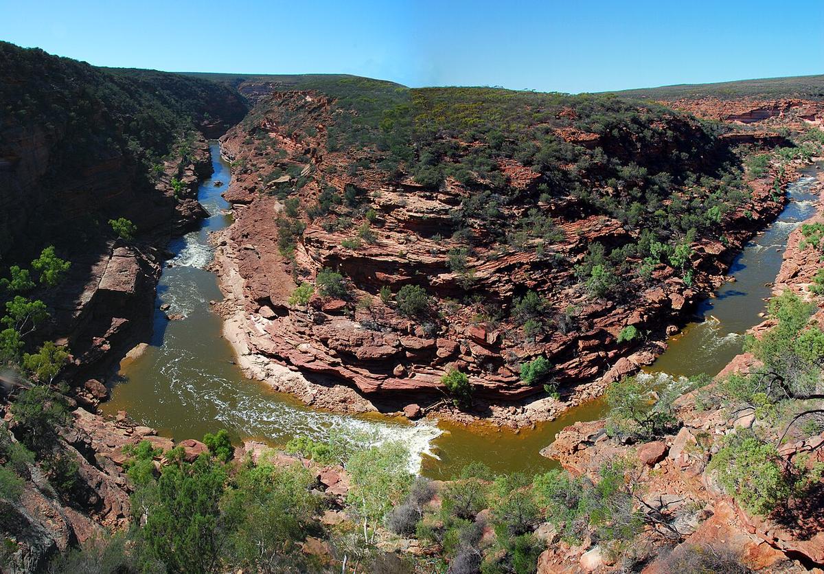
The Murchison River reaches the Indian Ocean at Kalbarri, on the Western Australian coast north of Geraldton. Its last stretch runs through Kalbarri National Park, where it has cut a deep, winding gorge through red and white banded sandstone. It is remote, hot and flood-driven, and when there is water in it the gorge is one of the great paddling settings in the west.
A river that comes and goes
The Murchison drains a huge, dry catchment. For much of the year the river inside the gorge is a chain of pools joined by shallow riffles and dry sand. After big rain in the catchment, often from the remains of a tropical system, it can rise fast and run brown and powerful for weeks.
Neither extreme is packraft paddling. Low water means long walks dragging over sand and rock. Flood water means strong current, standing waves and debris in a gorge with few ways out. The useful window sits between the two, and it does not arrive every year.
Heat is the first hazard
Summer in the gorge is severe. Air temperatures regularly climb past 40 degrees, the rock radiates heat, and shade is scarce at water level. People get into trouble on the walking trails here from heat alone.
Plan for the cooler months, start at first light, and carry far more water than you think you need. Treat any water you take from the river before drinking. Some trails can be closed in extreme heat, so check before you set out.
Inside the gorge
The gorge walls are steep and continuous for long stretches. Once you are down, getting out again is often only possible at the recognised trail points. That changes the whole trip: a sprained ankle or a burst hull a few kilometres from an exit is a serious situation.
Watch for rock bars and small drops that appear as the level falls, fallen timber jammed in the narrows after a flood, and sudden rises if storms are about. Scout anything you cannot see through.
Sections and access
The river is reached through Kalbarri National Park, with lookouts and walking trails at points such as Z Bend and the Loop near Nature's Window. Longer trips through the gorge are remote undertakings that need planning, a clear exit strategy and experience with self-rescue.
Near the town the river widens into its lower reaches and estuary before the mouth. This is the most approachable water on the Murchison, flat and easy to reach, though the river mouth and the bar where it meets the ocean are open coast and no place for a small craft.
Park passes, camping, trail status and any rules for paddling in the gorge are set by the Parks and Wildlife Service of the Department of Biodiversity, Conservation and Attractions. Check with DBCA before you go.
Levels and timing
There is no reliable season. Autumn through spring brings the milder weather, but whether there is paddleable water depends on what has fallen in the catchment, sometimes hundreds of kilometres inland. Check recent rainfall and any river level data available for the Murchison, and ask the park office about current conditions in the gorge.
Practical notes
- Mobile coverage is patchy or absent in the gorge. Carry a personal locator beacon or satellite messenger.
- Wear a buoyancy vest, and leave your trip intentions and expected exit time with someone reliable.
- Carry sun protection that covers you properly, and a hat that stays on in wind.
- Pack a repair kit you know how to use. Sharp sandstone is hard on fabric.
Where a Seeka fits
The lower river and estuary near Kalbarri, and calm pools in the gorge at a moderate level, are packraft water. Carry it down a trail, paddle a pool or two, and carry it out. Flooded gorge water and the ocean at the mouth are not what a Seeka is built for.