
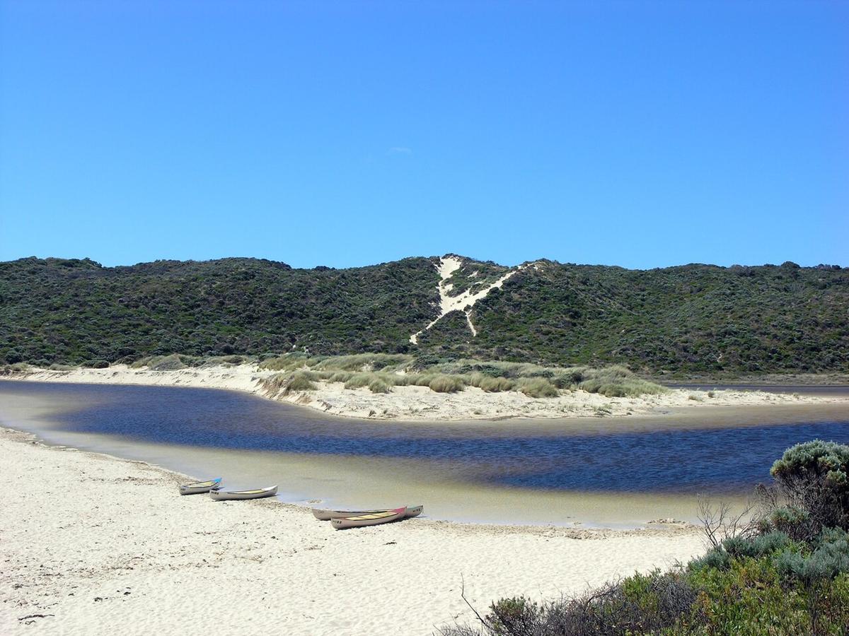
The Margaret River flows west through forest and farmland in the south west of Western Australia, past the town that shares its name, and reaches the Indian Ocean at Prevelly. It is a small river with a big reputation, and its lower reaches and lagoon mouth make a short, easy paddle on a coast better known for surf.
A small, seasonal river
The Margaret River is fed almost entirely by winter rain. From late autumn through spring it runs with real flow. Through summer it drops to a string of pools with little current between them.
That rhythm decides everything. In winter you have moving water, colder temperatures and the chance of fallen timber brought down by the flow. In summer you have calm, still reaches that are easy to paddle but can be too shallow in places to float a loaded hull.
Forest and pools above town
Above and around the town the river winds through karri, marri and jarrah forest, with steep banks and tannin-stained pools. Some of these reaches are pleasant for an out-and-back paddle on calm pools, carrying around the shallow sections between them.
Watch for snags and low branches in the narrow reaches, and for rock bars that show as the level falls.
The mouth at Prevelly
Near the coast the river widens into a lagoon behind a sand bar. For much of the year the bar is closed and the lagoon sits still behind the dunes. After enough winter rain the river breaks through to the sea, and the lagoon can drain with a strong outflow.
A closed lagoon on a calm morning is the gentlest paddling on the river. An open bar is a different place: the current runs out to the surf, and the break at the mouth is open coast. Stay well back from any outflow and do not paddle towards the ocean.
The coast either side of the mouth lies within Leeuwin-Naturaliste National Park, and the Cape to Cape Track passes the river mouth, so walkers and a packraft can share the same day out.
Getting to the water
The river passes through a mix of national park, state forest, public reserves around the town and private farmland. Rules differ between them and river frontage is often private.
Use established public access points, ask before crossing private land, and check with the Parks and Wildlife Service of the Department of Biodiversity, Conservation and Attractions and the Shire of Augusta Margaret River for current conditions and any restrictions.
Levels and timing
Late spring gives a good balance, with enough water left in the pools, milder air and settled mornings. Summer suits the lagoon and still pools. After heavy winter rain the river rises quickly and the mouth can open, so check recent rainfall and any river level data available before committing.
Wind off the ocean builds through most afternoons on this coast. Paddle the lagoon early.
Practical notes
Snakes are active on the banks in warm weather. The river and mouth are popular on summer weekends and holidays, so expect company on the lagoon.
Wear a buoyancy vest, tell someone your plan, and set a time to call when you are off the water.
Where a Seeka fits
The still lagoon behind the bar and the calm forest pools in summer are Seeka country. Walk in from the track or the road, paddle, roll it up and head for lunch. The open bar, the surf beyond it and the river in winter spate are not what a Seeka is built for.