
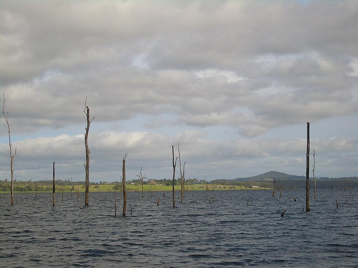
Lake Tinaroo is the large reservoir behind Tinaroo Falls Dam on the Barron River, up on the Atherton Tablelands in far north Queensland. Its long, branching shoreline of bays and inlets sits among farmland, rainforest and state forest, with the air noticeably cooler than on the coast below.
The dam was completed in the late 1950s, and the lake still carries the trunks of the forest it flooded.
A lake of arms and bays
Tinaroo is not one open sheet of water. It is a maze of arms and inlets, so a short paddle takes you around a headland and out of sight of the main lake and its traffic.
The northern shore backs onto Danbulla National Park and State Forest, where Queensland Parks and Wildlife Service runs camping areas near the water. That makes it easy to set up camp and paddle straight from the shore.
Drowned timber
Dead trees stand in the water across much of the lake, and more sit just under the surface. As the lake level drops, stumps and branches appear in water that looked clear a month earlier.
Paddle slowly near the stands of timber and in the shallow bays, and watch for anything that could puncture or snag a hull.
Crocodiles and safety
The Tablelands are part of far north Queensland, where estuarine crocodiles live in many waterways and the state asks everyone to Be Crocwise. Before you go, check the current crocodile advice for the lake with QPWS and Sunwater, and follow any warning signs on the shore.
The lake is shared with powered craft, water-skiers and people fishing for the stocked barramundi. Keep to the edges, stay out of ski areas, and wear something bright.
Wind, weather and levels
Wind builds across the main body of the lake, especially in the afternoon, and short chop can come up quickly in the open reaches. Morning is usually the calmest time. Stay close to shore and keep to the sheltered arms when the wind is up.
The wet season brings heavy rain, storms and lightning. The dry season, roughly from autumn through spring, is the settled window.
Lake levels change with rainfall and water use. Sunwater publishes current dam levels, and a low lake means more exposed timber and longer, muddier walks to the water.
Who manages the lake
Sunwater manages the dam and sets the rules for recreational use of the lake, including any restricted zones. QPWS manages the national park and state forest campgrounds, which need booking.
Tablelands Regional Council can tell you about public access points and facilities around the lake.
Wear a buoyancy vest, tell someone your plan, and set a time to call when you are off the water.
Where a Seeka fits
The sheltered arms and bays of Tinaroo, on a calm morning with camp on the shore, are just the kind of water a Seeka is built for. Roll it out at the campsite and paddle into the timber. The open main lake in a stiff afternoon wind is not.