
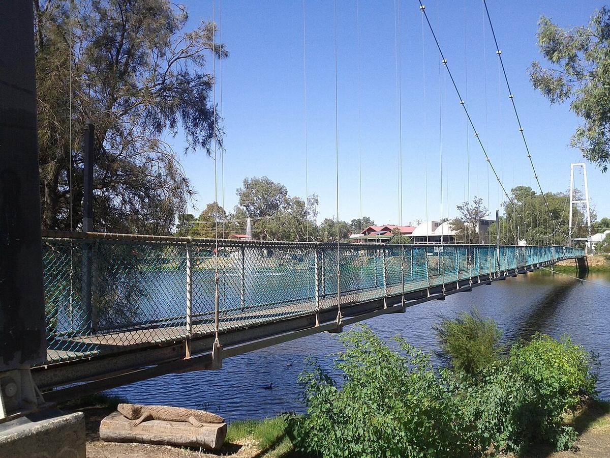
The Avon River runs through the wheatbelt east of Perth, past York, Northam and Toodyay, and cuts west through the Darling Range to become the Swan. For much of the year it is a string of pools across farming country. In a wet winter it becomes a flowing river, and through the hills it turns into whitewater.
It is a seasonal river first and foremost. Timing decides everything about paddling it.
A wheatbelt river
The Avon drains a large, cleared catchment. Summer leaves it low, with long, still pools in town reaches and dry or near-dry stretches in between. Parts of the river are brackish, a result of salinity in the surrounding farmland.
After good winter rain the river links up and flows. The change can be dramatic, and a stretch you walked across in autumn can be running strongly by August.
Northam and Toodyay
Northam sits on a broad pool held back by a weir, with parkland, walking paths and a pedestrian suspension bridge across the river. The town pool is home to white swans and is sheltered, flat and easy to reach.
Toodyay is further downstream, where the valley begins to narrow. The river through and around town has pools and moving water depending on the season.
These town reaches are where the Avon makes sense for a packraft. Launch from public parkland, paddle the pool, and treat the weir as a hard stop.
The valley below Toodyay
Downstream of Toodyay the river enters the Avon Valley and drops through the Darling Range, through Avon Valley National Park and on towards Walyunga National Park. In winter flows this section has rapids, fast water and rocky runs.
The Avon Descent, an annual winter race from Northam to Perth for power dinghies and paddlers, runs this whole river at high water. It is a whitewater event and should be understood as one.
Hazards
Weirs and causeways cross the river in several places. Never paddle over or through them, and portage well clear.
Snags, fallen trees and flood debris gather on bends and in the rapids. In high flows the river is cold, fast and powerful. In low flows the hazard reverses: shallow water, rock, and a long walk.
Levels and timing
The river usually flows from mid-winter into spring, depending on the rainfall that year. Summer and autumn are generally low. Check river height data and recent rainfall before planning anything outside the town pools.
Practical notes
Much of the river frontage between towns is private farmland. Use public reserves, ask landholders before crossing private land, and check access with the Shire of Northam or the Shire of Toodyay. For the national parks, check with DBCA.
Summer days in the valley are hot. Carry plenty of water and paddle early.
Wear a buoyancy vest, tell someone your plan, and set a time to call when you are off the water.
Where a Seeka fits
The Northam town pool and the gentle town reaches at Toodyay are good Seeka water, any season. Walk down from the main street and paddle. The valley rapids in winter flow, and the Avon Descent course at high water, are whitewater and not what a Seeka is built for.