
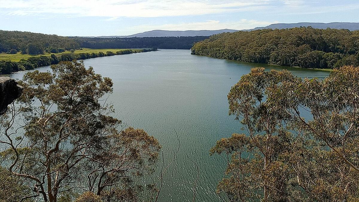
The Shoalhaven River rises on the southern tablelands of New South Wales, runs north through deep sandstone gorges, is held back by Tallowa Dam, and then turns east past Nowra to the sea. It is one river with three very different characters, and the paddling depends entirely on which one you pick.
Three rivers in one
The upper river crosses open tableland country before dropping into the long gorges of the Shoalhaven, bordered by Morton and Bungonia national parks. It is remote, steep-sided and flow-dependent.
The middle river is Lake Yarrunga, the reservoir behind Tallowa Dam, where the Kangaroo River joins. Our Kangaroo Valley guide covers that flat water and its paddle-in camping.
Below the dam the river winds east through farmland and forest to Nowra, and from there becomes a broad tidal estuary running out to the coast. This lower river is the focus here.
The upper gorges
The gorge country is wilderness paddling. Water levels swing from too low to float to dangerously high, walk-in and walk-out routes are long and steep, and there are rapids, rock gardens and portages that change with every flood.
It is a trip for experienced, self-sufficient parties with local knowledge and a good read of current levels. If it appeals, start with NPWS for access and camping, and find people who have run it recently.
Below Tallowa Dam
Tallowa Dam is managed by WaterNSW. Stay well clear of the dam wall and any outlet works, and observe every exclusion zone and sign.
Flow in the river below the dam depends on releases and on rain in the lower catchment, so conditions can differ from what the weather at the coast suggests. Check WaterNSW for current release information before paddling below the dam.
The Nowra estuary
From around Nowra downstream the Shoalhaven is tidal. The river is wide and slow, lined by sandstone bluffs in places and by farmland and mangrove flats in others. Hanging Rock lookout in Nowra looks straight down on it.
Tide sets the pace down here. Plan to ride the flood tide in one direction and the ebb in the other. Wind against tide on the wider reaches builds short, steep chop that is uncomfortable in a small craft.
This is also a busy waterway, with powered craft, water-skiers and anglers, especially around Nowra on weekends. Keep to the edges, stay out of the main channel, and make yourself easy to see.
Where the river meets the sea, near Shoalhaven Heads and Crookhaven Heads, the water becomes open coast with bars and swell. That is no place for a packraft.
Levels and timing
The Shoalhaven catchment is large and can flood hard after east coast lows. The estuary is paddleable most of the year, but brown floodwater, debris and strong ebb currents follow big rain. Give it a few days to settle.
Summer brings warmer water and afternoon sea breezes. Winter mornings on the estuary are often calm and cool.
Practical notes
Public boat ramps and reserves around Nowra and the lower river give easy access. Much of the riverbank elsewhere is private, so launch from public land.
Avoid swimming or immersion in the estuary after heavy rain, when water quality drops. Check Transport for NSW for boating rules on the waterway.
Wear a buoyancy vest, and leave your trip intentions and a time to call with someone before you go.
Where a Seeka fits
The calm tidal reaches around Nowra, paddled with the tide on a still morning, suit a Seeka well. So does Lake Yarrunga. The upper gorges in flow and the open water at the heads are not what a Seeka is built for.