
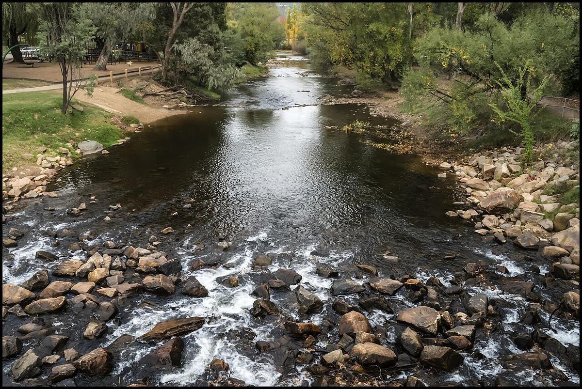
The Ovens River runs out of the Victorian alps above Bright, down through Myrtleford and Wangaratta, and into the Murray. It is one of the more accessible alpine-fed rivers in the state, with a road following much of its length.
That accessibility is what makes it useful for packrafting. You can reach the water in a lot of places without a long approach.
An alpine-fed river
The upper catchment collects snowmelt and rain from the Alpine National Park. Spring brings the fullest flows. By late summer the upper river can be low enough that paddling turns into walking between pools.
Water off that country is cold. Air temperature in the valley is a poor guide to what you would be swimming in.
Braided gravel and shifting channels
Through the middle reaches the Ovens runs over gravel, splitting into channels around bars and islands and rejoining. The picture changes after every high flow.
That means two things. Choosing the right channel at a split is a real decision, because the wrong one can end on a gravel bar or in a log jam. And local knowledge ages fast here, so treat old trip notes as history rather than instruction.
Log jams are the main hazard
Timber piles up on the upstream side of gravel bars and on the outside of bends. Water goes through. A packraft does not.
On a braided river you can come around a bend and find a channel blocked with no room to stop. Keep your speed down, look well ahead, and get out and scout when you cannot see through.
If in doubt, take the wider, slower channel, even if it is longer.
Sections and access
The upper river around Bright and Porepunkah is steeper and rockier, and is generally a spring proposition. Below Myrtleford the gradient eases and the river broadens.
Towards Wangaratta it slows into long flat reaches through farmland and river red gum flats, joining the King River before it reaches the Murray.
The Murray to Mountains Rail Trail runs near parts of the valley, which makes the bike-and-paddle combination simple here. Ride to a put-in, paddle down, ride back. Check current access and conditions with Parks Victoria and the local councils.
Levels and timing
Spring through early summer usually gives the most reliable paddling. Late summer and autumn can be too low on the upper sections and still fine lower down.
Storms in the alps lift the river quickly. Check gauge data and recent rainfall, and know that a rise can arrive hours after the rain that caused it.
Practical notes
Much of the river frontage is private farmland even where the water is public. Use established access points and ask permission rather than assuming.
Willows are widespread along the middle and lower river and form strainers. Fences across the water occur on rural sections.
Wear a buoyancy vest, tell someone your plan, and set a time to call when you are off the water.
Where a Seeka fits
The flatter middle and lower reaches, reached on foot or by bike from the rail trail, are the kind of day a Seeka is built for. The steep upper river in spring flow, and whitewater anywhere, are not.