
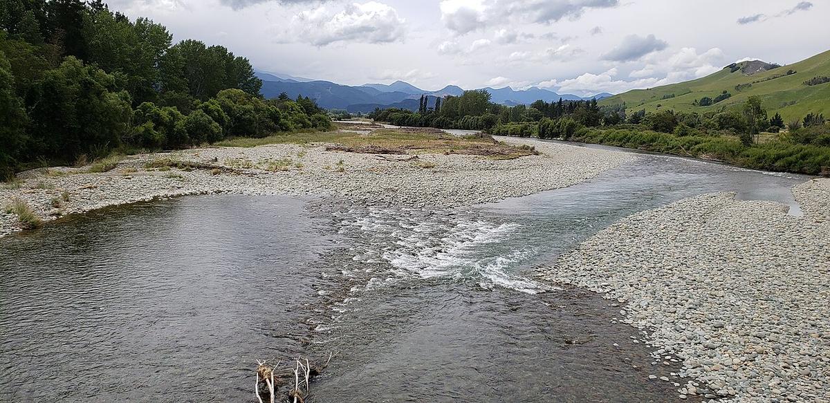
The Motueka River runs north through the Tasman region of the South Island, from the hills south of Tapawera down a long farmed valley to Tasman Bay at Motueka. It is a clear, gravel-bedded river, braided in places and lined with willows, with long gentle reaches between the riffles.
A road follows the valley for most of its length, so getting to the water is simple. That makes it a good river for short, flexible days.
Gravel, riffles and clear water
The Motueka is a classic South Island gravel river. Wide shingle beaches, channels that split around bars and rejoin, and runs of shallow riffle between longer pools.
The water is usually clear, which helps. You can read depth and spot rocks far better than on a dark tannin river. In low summer flow some riffles get shallow enough that you step out and walk the packraft through.
The river is also well known for its brown trout. Expect to share the banks with anglers, and give them room when you pass.
Willows and moving channels
Willows line much of the middle and lower river. Where the current pushes into a bank under overhanging branches, they form strainers, and water passes through where you cannot.
Braids change after every flood. A channel that ran clean last season can end in a pile of wood or a gravel bar this one. Look well ahead at every split, choose the channel with the most water and the clearest line, and get out to look when you cannot see around a bend.
Reaches and access
The upper river around Tapawera is smaller and more gravelly, with tributaries such as the Wangapeka joining nearby. Through the middle valley the river broadens and the reaches lengthen. Towards the coast it slows before reaching Tasman Bay near Motueka.
The Motueka Valley Highway runs along the valley, with bridges and reserves giving access at intervals. Much of the adjoining land is private farmland and orchard. Use established reserves and access points and ask before crossing paddocks. Tasman District Council is the place to check current access and local conditions.
Levels and timing
Summer and early autumn usually bring the lowest, clearest and most predictable flows, which suit an easy float. Spring and winter can run higher, colder and faster.
Heavy rain in the ranges lifts the river quickly and brings down fresh wood. Check the regional flow data and the forecast before you go, and leave it for another day if the water is high and brown.
Practical notes
Check, Clean, Dry your packraft, paddle and gear between waterways to avoid spreading freshwater pests such as didymo.
Some South Island rivers grow toxic algae mats in warm, low summer conditions. Check the regional council and LAWA for current warnings, and keep dogs out of the water where mats are present.
Wear a buoyancy vest, tell someone your plan, and set a time to call when you are off the water.
Where a Seeka fits
Clear gravel reaches at a summer flow, a short walk from the road, are the kind of day a Seeka is built for. Pair it with Abel Tasman or the Nelson Lakes and you have a week of Tasman paddling. High, dirty water after rain is not the time.