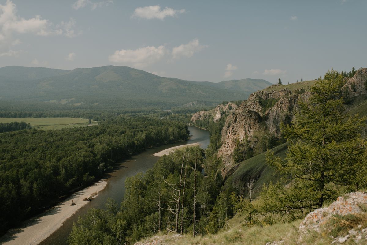
The Mitta Mitta starts in the Victorian Alps and swings through a long arc of widening valleys before it reaches Lake Hume near the New South Wales border. This is river-journey country. Forested ridgelines, camps with nobody else in them, long stretches where the only sound is water over rock. The river covers a wide range, from unhurried valley reaches that make a relaxed day out to committed gorge water that calls for experience and the right kit. Know which part of the river you are looking at, and what the water is doing on the day you arrive. Everything follows from that.
One name, several rivers
The Mitta Mitta is not one kind of river. The upper catchment drains steep high-country terrain, and the tributaries feeding it come off the Great Dividing Range. The mid and lower sections open into broader valleys before the river meets Dartmouth Dam. Below the dam it changes character again, running through gorge country before it widens toward the plains and Lake Hume.
Some sections are approachable touring water at the right levels. Others sit well outside the range of most recreational paddlers, whatever the conditions. The same river name covers both. Look closely at exactly which section you are planning before you commit to anything.
The dam factor
Dartmouth Dam sits on the Mitta Mitta and is one of the largest storages in the Murray-Darling system. Releases are managed for irrigation and environmental purposes, and those releases set the river level below the wall. This is not a river that answers only to rain you can see falling upstream.
Below the dam, levels rise and fall on a schedule set by operators, not by weather. Last week's gauge reading is incomplete information. Check current levels and release information before you plan any section below the dam, and do it close to your departure date, not weeks out. The gorge country below the dam is particularly sensitive to release levels. What is manageable at one flow is a different proposition at another.
The range of water
At the right levels the valley reaches give you proper touring. Wide water, gravel bars, forested banks, and a pace that lets you read the river without being rushed. These are the sections where a relaxed multi-day journey is on for paddlers with basic river skills and the patience to wait for conditions.
The gorge sections are a different category. They involve serious whitewater and belong to paddlers trained and equipped for that environment. Scouting and a realistic assessment of your own skills are not optional there. The gorge is not an extension of the valley touring water. It is a separate class of paddling.
Understand which section you are looking at before you put on the water. Local knowledge matters. So does an honest read of your own skills. Check current levels and release information before planning, every time.
The multi-day pattern
The Mitta Mitta lends itself to multi-day river journeys. Long sections move through country no road reaches, and the river gives you both the route and the pace. The pattern is simple: float, camp, float. The valley reaches away from the gorge have room for camps on river banks and gravel bars, though land tenure varies between public and private.
Check the land status of any campsite before you go. Some river-bank country is Crown land or part of the alpine park system; other sections are private. River access does not grant camping rights. Contact Parks Victoria or the relevant land manager if you are unsure.
You are on your own out here, so plan for it. The valleys are sparsely populated and mobile coverage is unreliable. Carry food for an extra day and a means of emergency communication that does not depend on mobile signal. Tell someone your itinerary and a realistic return time before you leave.
Hazards
Level changes are the primary hazard below Dartmouth Dam. A river that was safe to camp beside at sunset can be significantly higher by morning after a scheduled release. Camp above the flood line, not on the gravel bank at the water's edge. Know what the release schedule looks like for the whole of your trip.
Cold water runs through the whole system, particularly the upper reaches and the alpine tributaries. Even in summer, water in this country pulls heat from a swimmer fast. A wetsuit or drysuit is the right call for any section with moving water. Your PFD stays on whenever you are on the water.
The valleys are remote. In the gorge sections self-rescue is difficult and outside help is a long time coming. Be honest about the consequences of a swim before you commit to any section. Scouting is part of the job on water like this. Walk the bank whenever you cannot see clearly what is ahead.
Strainers wait wherever trees line the bank. Fallen timber and overhanging vegetation collect on the outside of bends and where the river narrows. Pick your line before you reach them, not as you arrive.
Who belongs where
Touring paddlers belong on the valley reaches at calm, friendly levels: water that is moving but readable, with a pace that gives you time to make good decisions. Those sections reward basic river skills and the patience to wait for the right conditions rather than paddling regardless.
The gorge sections belong to whitewater paddlers with the training, experience and rescue skills for that environment. There is no middle ground. Arriving underprepared on a dam-controlled gorge river is a serious situation.
Nobody belongs on any part of the Mitta Mitta in flood. A rising, turbid river with debris moving on the surface is not an invitation. Pull the packraft out and wait.
A Seeka fits the gentle valley reaches at the right levels. The gorge country calls for a different craft.