
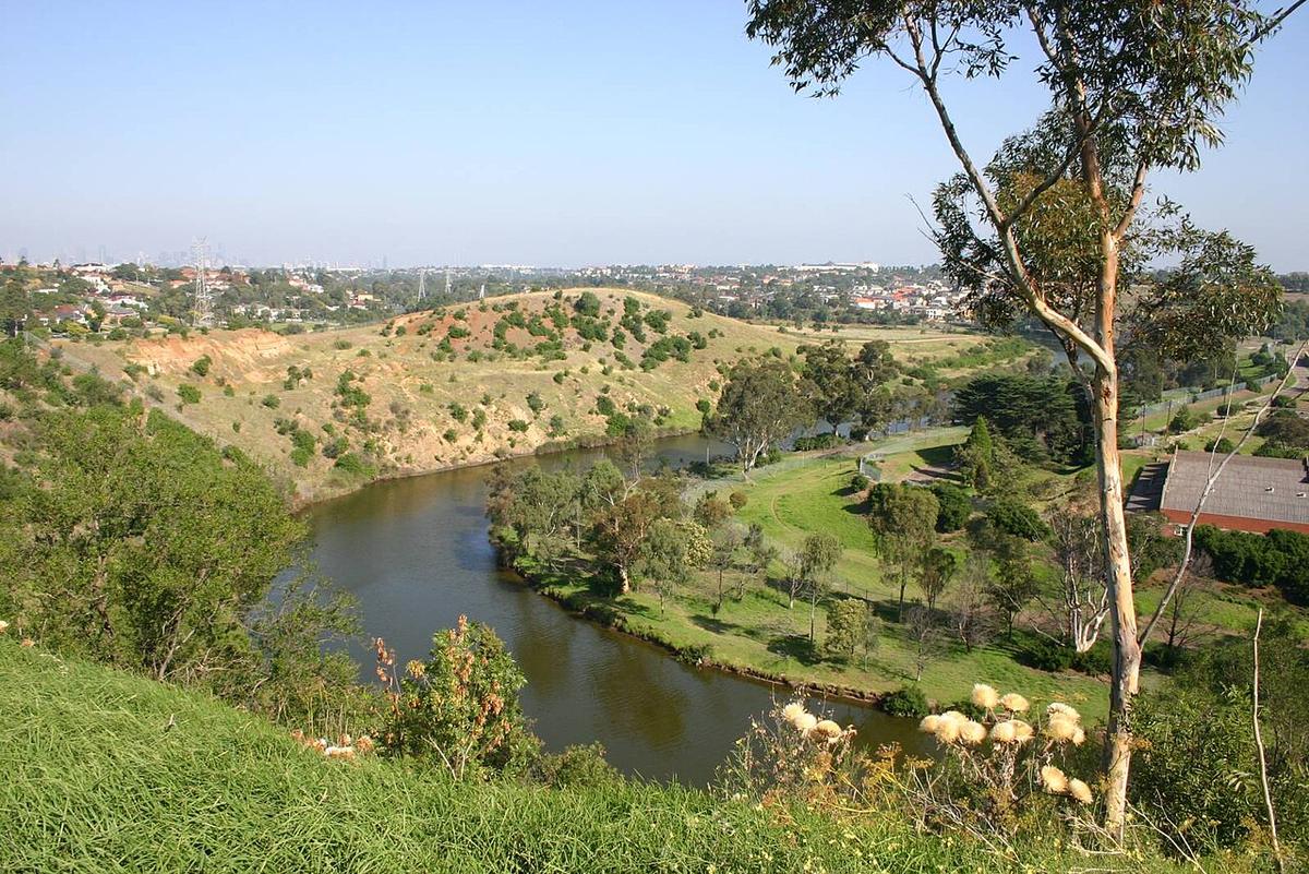
The Maribyrnong River runs through Melbourne's west, from the rural creeks north of Keilor, through a deep valley at Avondale Heights and Maribyrnong, and down past Footscray to join the Yarra near the port. The lower river is tidal, and the whole length sits within the suburbs.
That makes it one of the easiest rivers in Melbourne to reach with a packraft on your back. Most of the valley is parkland, and a shared trail follows the water.
Two rivers in one
Above the tidal limit, the Maribyrnong is a small river in a valley cut through basalt. Its level follows the rain in the catchment around Sunbury and the Macedon Ranges, and in dry spells it can drop to a trickle over rocky shallows.
Below it, the river is wide, brown and tidal. It rises and falls with the bay, and the current changes direction through the day.
The change happens around the ford near Canning Street at Avondale Heights, where a rock bar marks the upper reach of the tide. Treat the ford itself as a place to get out and walk, not to paddle over.
The Avondale Heights reaches
Around Avondale Heights and Maribyrnong the valley is at its most enclosed. Steep grassy banks, river red gums and parkland on the flats give it a sense of distance from the city around it.
This is the stretch for an easy there-and-back. Launch on the tidal side, paddle with the tide, and turn in time to ride the change home.
The lower river
Downstream towards Footscray and the Yarra junction, the river becomes a working waterway. There are cruise boats, rowing clubs, moorings, pontoons and wharves, and wakes that reflect off hard banks.
Keep to the edges, stay visible, and give rowers and larger craft plenty of room. The junction with the Yarra and the port beyond carry commercial shipping and are not packraft water.
Rain and water quality
The Maribyrnong responds quickly to heavy rain. The catchment is large and much of it is cleared or paved, so the river can rise fast and carry debris. The river valley flooded badly in October 2022, a reminder of how much water it can carry.
Urban runoff also affects water quality for a few days after rain. Check advice from EPA Victoria and Melbourne Water before you paddle, and avoid swallowing the water or paddling with open cuts after a storm.
Tides and timing
On the tidal reaches, plan the trip around the tide times for Port Phillip rather than the river alone. A strong outgoing tide after rain can make the paddle back upstream heavy going.
Mornings are usually calmer. Afternoon winds funnel along the valley, and the lower river is open to them.
Practical notes
Access points, parking and rules on pontoons are set by the local councils and Parks Victoria, and they change with works along the river. Check before you go, and use public ramps and banks rather than club pontoons.
Wear a PFD, tell someone your plan, and set a time to call when you are off the water.
Where a Seeka fits
The tidal reaches below Avondale Heights are made for a Seeka: take the train or ride the trail in, paddle for an hour or three, and roll it back onto your pack. The rocky ford at low flow, and the port end of the river, are not.